Tuesday, May 19, 2015

Capitol Reef

After our detour up to SLC to avoid the storms in southern Utah, we headed back down to Capitol Reef National Park. We knew that the campground in the historic Fruita District was very highly rated, and since it was first come first served for only $10, we got on the road as early as we could. We arrived around 10:30am in drizzling rain, grabbed a site, and by 11 or 11:30am the rest were taken as well. The lesson we seem to be learning over and over again is that first-come-first serve campgrounds fill early.

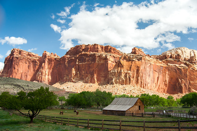
The Fruita Campground is nestled in a valley that was originally developed by Mormon settlers at the end of the 18th century. Surrounded by striking sedimentary rock formations, the valley is an oasis of fruit trees, still watered by the gravity fed irrigation ditches originally dug by the first settlers. Many of the trees are rare varieties of pears, cherries, and apricots that are no longer cultivated.  Sadly, there wasn't any ripe fruit on the trees while we were there, but later in the year you're free to pick and eat whatever you like for free! We read that they charge a small fee for anything you don't eat on the spot.  Signs near the orchard said that the fruit yield often exceeds demand in the summer.

In addition to the campground and orchards, there are some original buildings still standing such as the schoolhouse, blacksmith shop, and our favorite, the Gifford House. The tiny house has been turned into part museum, and part pie and cinnamon roll shop! Unlike the mega tourist centers in Zion and Grand Canyon, the little house still had a quaint, quiet feel to it, thanks in large part to the friendly staff and the smell of homemade baked goods.

The weather was a mix of clouds, sun, and a bit of rain while we were there. Daytime temperatures were cool and perfect for hiking, so we went on a number of hikes while we were there, including the Rim Overlook trail, Hickman Bridge, Cohab Canyon, and the Fremont River Trail.
Untitled
At the base of these cliffs is the Gifford House, where we enjoyed pies and cinnamon rolls

Saturday, May 16, 2015

Salt Lake City

We decided to take an impromptu trip to Salt Lake City from Bryce Canyon.  The weather looked a little clearer, and we wanted a few days to dry out before heading back into the thunderstorms rolling through southern Utah. Plus, Matt had never seen the city, and I had only spent a few hours there with my mom on our cross country trip 11 years ago.

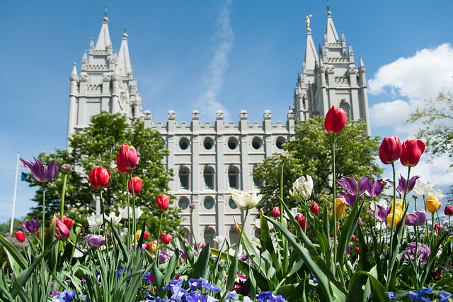
Our first stop was Temple Square, which we heard was a peaceful oasis of flowers amidst the bustle of downtown.  Temple Square is the 10-acre headquarters for the Church of Jesus Christ of Latter-day Saints, and most of it is open to the public for tours or just strolling through on your own.  We opted to walk along the many beautiful gardens, stopping to smell the flowers and take in the tranquility of the place.  The grounds seemed to be buzzing with activity -- lots of business people walking from building to building, tourists, and families with small children posing for Spring portraits. On certain days you can even hear a free concert from the Mormon Tabernacle Choir, but sadly we weren't there on the right day.

Untitled
Gardens and architecture at Temple Square

Bryce Canyon

We were a little apprehensive arriving in Bryce Canyon National Park, since we didn't have camping reservations and we were told that the first-come first-serve campsites filled quickly. We got an early start from Zion and headed north to Bryce.  Upon arriving at the campground, we discovered that the major loop of first-come first-serve campsites was inexplicably closed. We grabbed one of the remaining sites and set up camp.  Only about 30 mins or so later, the campground was full, so we were glad we got a nice spot in the shade.

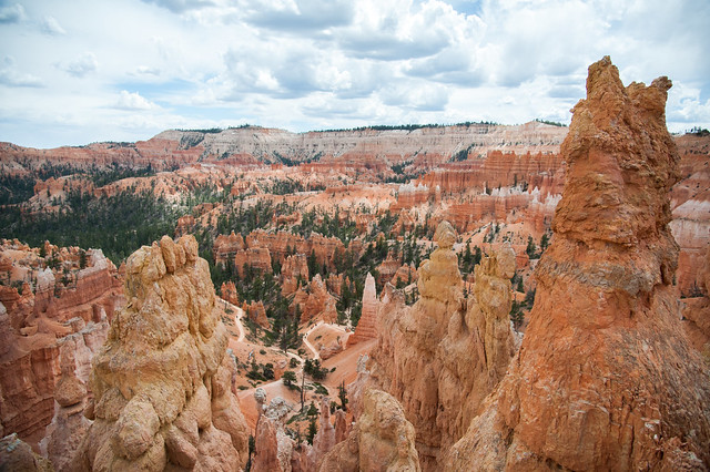
Bryce is famous for its thousands upon thousands of natural rock spires, most of them concentrated in what is called the Bryce Amphitheater.  These spires are known as "hoodoos", and they were formed as ice and rain eroded the limestone and sandstone cliffs that once stood there.  You can see the layers of orange and white colored rock everywhere in the park.

We decided to do as much as possible on our first day, as thunderstorms were expected for the following day and the rest of our time in the park.  We started with the the Queen's Garden trail, which lead down into the canyon amphitheater among the hoodoos. It was really cool to see the rock formations up close, and it was surprising how big they are once you stand next to them. 

Untitled
View from the top of Queen's Garden Trail -- you can see the trail and tiny people down below

Friday, May 15, 2015

Zion National Park

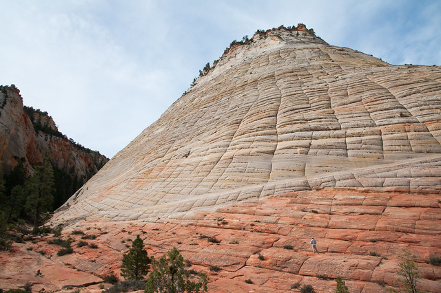
We got to Zion not knowing much about the park, and not really sure what to expect.  We entered the park from the east along Zion-Mt Carmel Highway and drove through spectacular rock formations.  The park is characterized by its towering red sandstone cliffs, crackled mesas, and slot canyons. Almost everywhere you look in Zion, there are unique patterns in the rocks and cliffs that surround you.

Untitled
Matt explores the Checkerboard Mesa

Tuesday, May 5, 2015

Lower Antelope Canyon

From the Grand Canyon, we headed for Page, AZ.  This town is situated among many popular attractions, like the famous horseshoe bend of the Colorado River and Antelope Canyon.  You could spend a number of days here seeing all of the sites and exploring the beautiful and at times other-worldly scenery here.  Even the rock formations along the highway into town are startlingly beautiful – we saw undulating hills and cliffs made of vivid oranges, pinks, purples, yellows, and even blue-greens.

Since our time was limited, we decided to check out Antelope Canyon while we were in town.  This canyon is on Navajo land, so all visitors are required to have a guide. We usually prefer to self-navigate through parks, but having a guide to tell us about the Navajo culture, history, and special features of the canyon was really useful and made our visit more memorable.

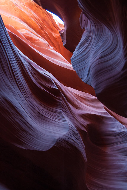
Antelope Canyon is divided into two halves: upper and lower.  Separate tour companies have guides for each, so we decided to see the slightly less-popular lower Antelope Canyon.  To get into this canyon, you have to climb down a series of very steep ladders.  Once you do, though, you are about 30 feet down in a slot canyon made of Navajo sandstone, some of the softest stone in the world.  Over time, water carved away the canyon walls in remarkable swirling shapes.  Our guide, Van, said that the canyon still has very dangerous flash floods about every 3 years.  These floods are so violent that they can tear away whole chunks of wall and smash boulders into the sides of the canyon walls (we saw examples of both from previous flooding). 

It took about an hour to walk through the entire canyon, stopping every few feet for photos and for information from Van.  He pointed out many rock formations that the Navajo have named for their resemblance to animals and people, and he also told us a little about how the Navajo had traditionally used the canyon for shelter, water, and protection from enemies.

As the sun lights the canyon walls from above, the sandstone reveals a breathtaking rainbow of colors and undulating forms.  Photographers have flocked here for decades because of the almost surreal colors created by the light here.  I was surprised at how vivid the colors are in person, having assumed that most of the professional photos I've seen had been drastically altered in photoshop.  While I'm sure some of them have been, the canyon light does do seemingly magical things to the color of the stone.

Untitled

The Grand Canyon

We arrived at the Grand Canyon to discover that the South Rim where we were camping is actually at 7,000 ft elevation. This meant that the weather was still pretty cold in mid-April, with nighttime temps dropping below freezing, and daytime temps just barely cracking 50 degrees. Luckily, we were prepared with wool hats, gloves, and down sleeping bags.

We were less prepared for the big storm that rolled through the area on our first day in the park. All the weather reports seemed to agree that the storm would last all day, with a mix of rain and snow. We decided to head to Flagstaff for the day and avoid our wet and chilly campsite. We checked out the Lowell Observatory, and then headed for a couple of coffee shops in downtown Flagstaff to watch the storm and catch up on emails and photos. The rain turned into a pretty significant snowstorm in the evening, and although our tent was encrusted with ice and snow when we returned after dinner, all was well at our campsite.

The next morning brought temps above freezing, so most of the snow that had accumulated during the night melted before 9am. We decided to spend the day walking the rim trail along the southern canyon wall, and a short stretch of the South Kaibab trail down into the canyon. It was a beautiful day for a hike! 


Untitled
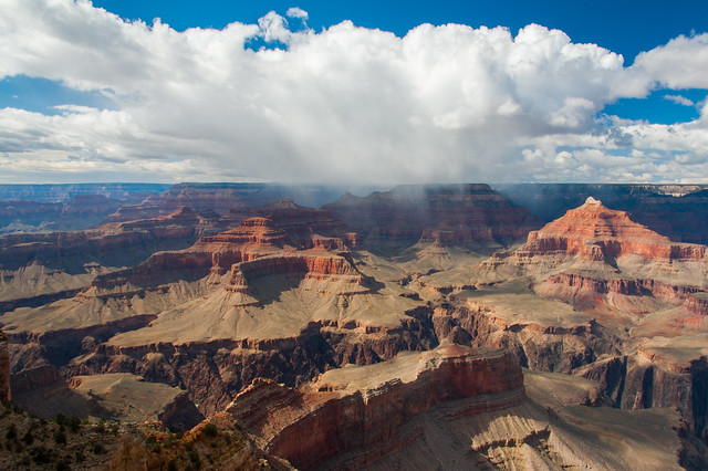
Remaining thunderstorms along the North Rim

Untitled
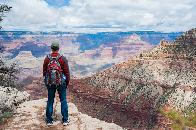
Matt surveys the landscape

Untitled
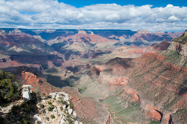
Nice views and pretty clouds all day from the South Rim

Untitled
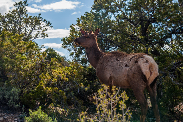
Elk where everywhere -- this guy was having lunch right on the trail

Untitled
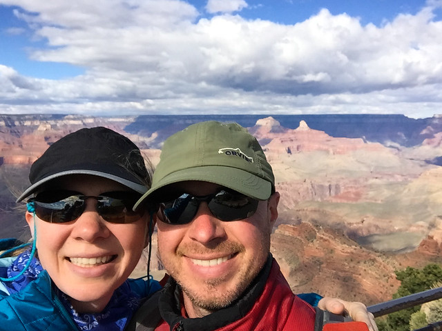
Grand Canyon selfie!

A few more photos from the Grand Canyon can be found here.

Monday, May 4, 2015

Joshua Tree

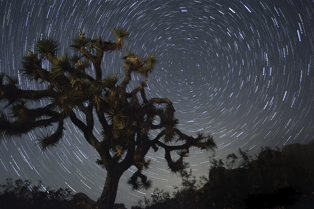
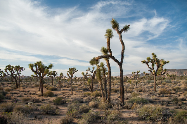
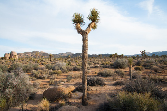
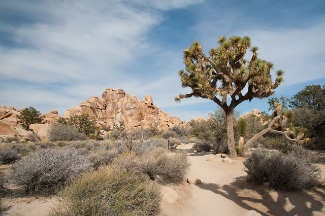
After Death Valley, Joshua Tree was our next stop.  By comparison, Joshua Tree was pleasantly cool throughout the day and teaming with life.  Immediately upon entering the park, we were amazed by the forest of Joshua trees in the main valley.  They look like they belong in a Dr. Seuss book, and there are acres and acres of them as far as the eye can see.  We never quite got used to their strange shapes while we were there.

Untitled

Untitled

Untitled

Untitled

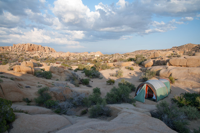
We were lucky to grab a really cool campsite when we arrived at Jumbo Rocks campground.  Site 113 is recessed from the road and nestled among some of the park’s giant rock formations.  We enjoyed climbing up to the top of our little boulder piles and surveying the landscape periodically.

 
Untitled
Our campsite and view over the camgrounds

Untitled
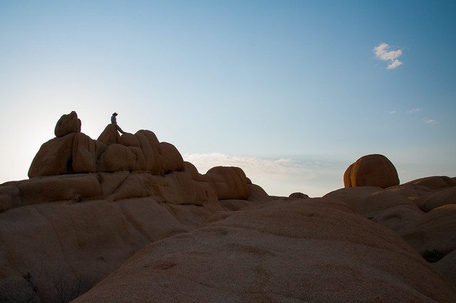
Matt surveys the landscape on our first night

We learned that these rock formations are all granite, which makes them very easy to climb.  We saw tons of rock climbers while we were in the park, and we did a little bouldering ourselves. A good explanation of how the rock formations were created can be found here.

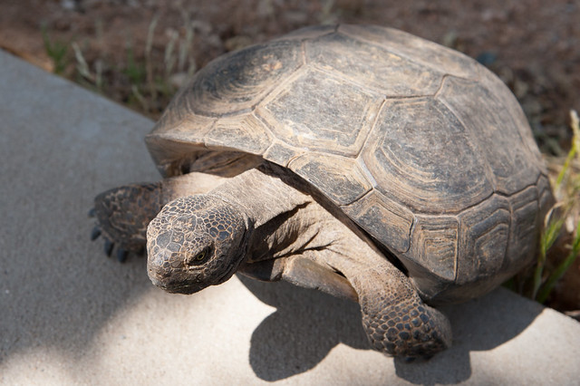
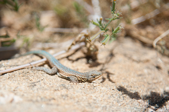
On our first full day in Joshua tree, we explored the upper half of the park, which is part of the Mojave Desert.  We opted to do lots of shorter hikes instead of one longer one so that we could see many different areas in one day. We were struck by how much life there is here, and how many diverse species live in this area.  We saw lots of lizards, cacti, quail, humming birds, doves, cottontail rabbits, a (supposedly rare and endangered) desert tortoise, and much more.

Untitled
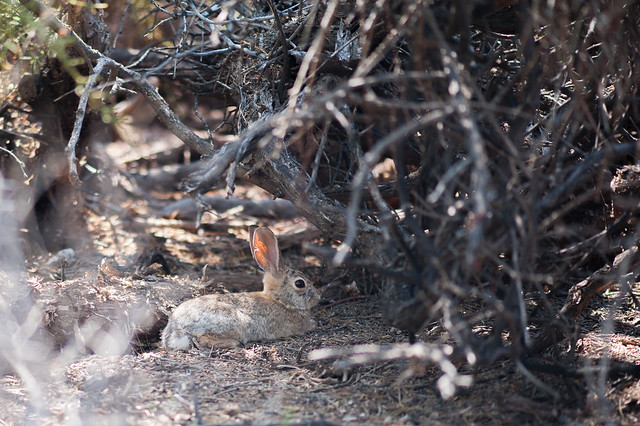
Cottontail rabbit at the Oasis of Mara

Untitled
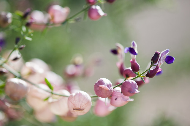
Paper Bag bush at our campsite

Untitled
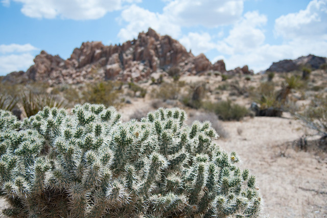
Cactus along the Indian Cove trail

Untitled
Desert Tortoise outside the Black Canyon Ranger Station

Untitled
Tons of lizards everywhere; this guy was on the High View trail

Untitled
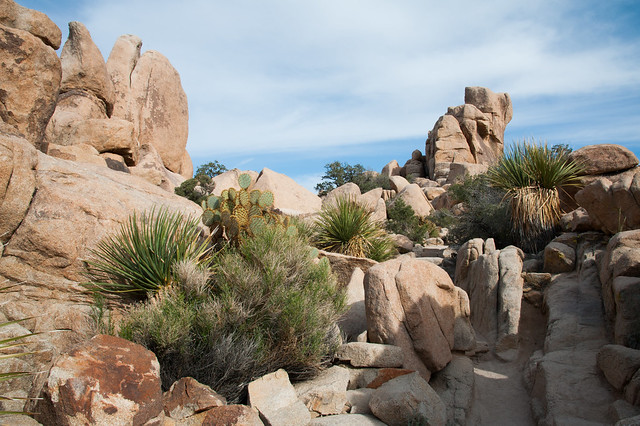
Yucca and other cactus along the Hidden Valley trail

Untitled
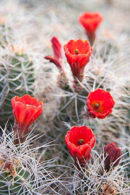
Cactus blooms along the Barker Dam

Untitled
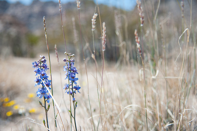
Wildflowers at Indian Cove

Untitled
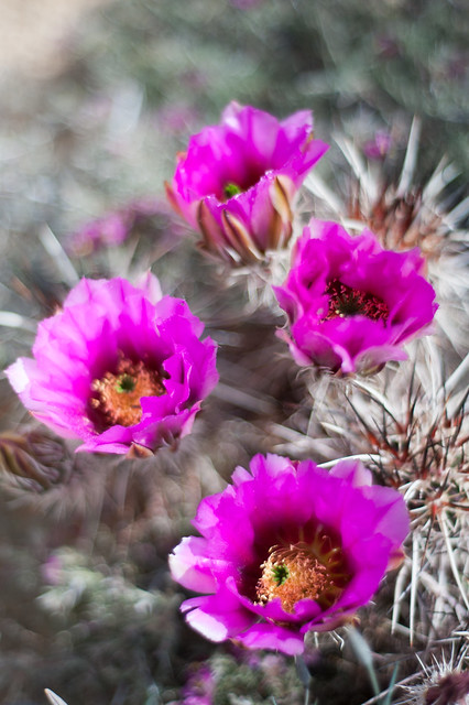
Cactus blooms along Skull Rock trail

Untitled
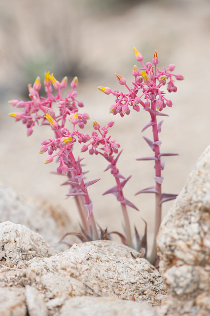
Succulents by the campsite

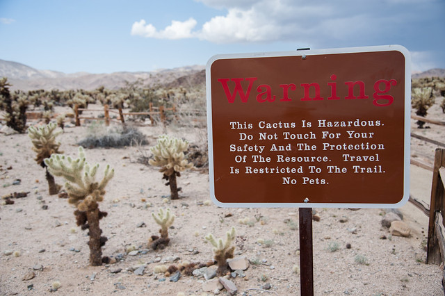
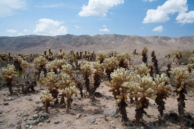
On our second day, we headed south.  The park spans the border between the Mojave and the Colorado Desert, with the transition zone between these two ecosystems bisecting the park roughly in half.  The Colorado Desert looks very different from the Mohave; instead of Joshua trees and boulder piles, Cholla Cactus dominate the landscape. 

Untitled
Ominous warning sign at the Cholla Cactus Garden

Untitled
The Colorado Desert

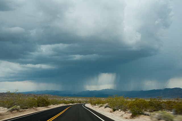
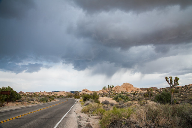
The second day also brought some isolated thunderstorms, which briefly added some drama to the desert sky.  Luckily they passed quickly and didn’t dampen campsite too much (an added bonus being that they washed off some of the bugs from our car!).

Untitled
Driving north along the Pinto Basin Road

Untitled
Dark clouds over the campgrounds

The full set of photos from Joshua Tree can be found here.