
For our entire week in Boulder the daily forecast was 100% chance of scattered thunderstorms. We did our best to get out and explore, but if we're honest we also spent a lot of time enjoying the creature comforts of staying in an apartment rather than camping: aka watching TV and eating ice cream... Also a lot of photo editing!
When we did get out to see the town, there was a lot to see. Being huge nerds, we started at the National Center for Atmospheric Research (NCAR), where there is a cool little science museum about climate and weather. That same morning the weather was clear and sunny, so we also took a stroll through the Pearl Street mall, a shopping district with lots of restaurants, pubs, and stores. Later in the week we walked along the Boulder Creek bike path, which follows some gentle rapids through town. We saw lots of families, bikers, kayakers, and fisherman enjoying the space.
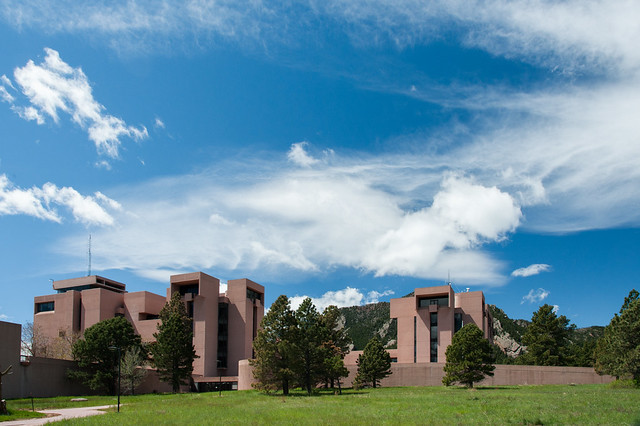
National Center for Atmospheric Research (NCAR), designed by I. M. Pei

Street art near Pearl Street in downtown Boulder

Kayaker in Boulder Creek (the "creek" right through the center of town!)
When we headed into the Rockies, we didn't expect to find much that was open. To our surprise, the visitors center was pretty busy, and some roads were open despite the snow. We did a short hike over some deep snow to see Bear Lake and Nymph Lake, but decided we were probably underprepared for more than a mile or so. Some day use areas at lower elevations were clear of snow, so we checked out Sprague Lake after lunch, then hiked a 5-mile loop up to Cub Lake.
The Cub Lake hike first crossed Moraine Park, a large meadow where we saw tons of deer and elk grazing. The trail gently climbed through some beautiful aspen trees just getting their spring leaves, and we criss-crossed spring streams heavy with snow melt as we climbed.
After the hike, we decided to try to drive as far as we could along the highest road in the US, Trail Ridge Road. Since the Jetta has been to the lowest point in Death Valley, it seemed only fitting that it should also see the highest. Unfortunately, we weren't able to make it all the way to the 12,183 ft summit due to heavy snow, but we got just shy of 11,000 feet before hitting a road closure that forced us to turn around. The road was socked in for most of the drive, so sadly we didn't get to fully appreciate how high we really were, but we took a few pictures anyway.

Bear Lake

Sprague Lake

Chipmunk! Much larger and less stripey than the ones we saw in the desert

Cub Lake

Yellow bellied Marmot, posing for a photo

Elk in Moraine Park

Aspen trees

Rainbow Curve on Trail Ridge Road, the highest road in the US
The full set of pictures can be found here: Flickr
No comments:
Post a Comment
Please log into your Google or Gmail account first before typing a comment, otherwise blogger will take you to a login page when you hit "publish" and your comments will be lost!