
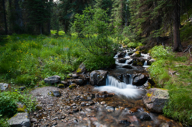
We decided to hike up to see the Peyto Lake overlook. The path here was less a trail and more a maze through mossy forest -- the trail frequently split two or three ways, only to split again just a few steps ahead. In the more open areas of the forest, you could see paths criss-crossing each other every few feet. Everywhere you looked there were baby evergreen trees, lush patches of moss, lichens, and wildflowers. We meandered along several paths and eventually we made it to the overlook for stunning views of the lake.
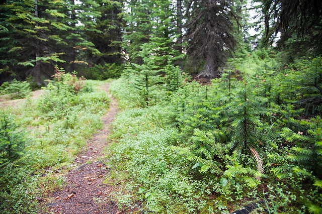
Peyto Lake trail
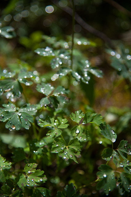
Raindrops collecting in the leaves
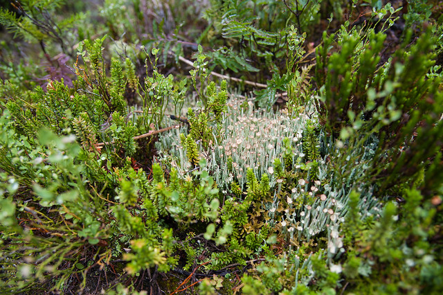
Lots of lichens
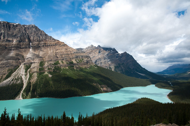
Peyto Lake from the overlook
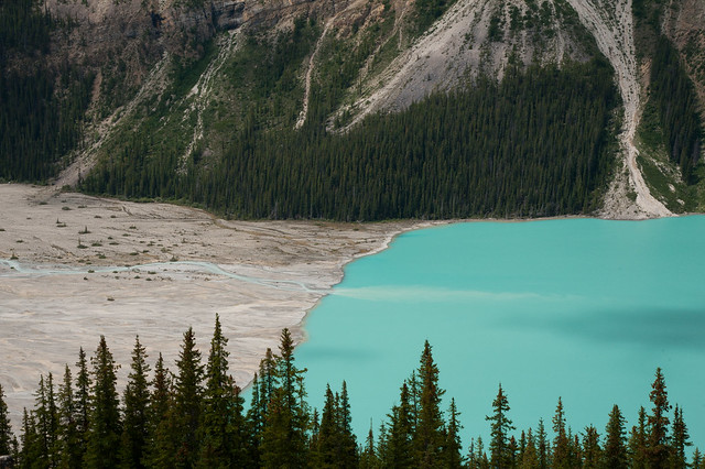
Peyto Lake is fed by the melt water from Bow Glacier
We continued north after Peyto Lake and were mostly blessed with clear skies for the rest of our drive. We stopped at a few more scenic pull-offs but didn't hike much more until we got into Jasper National Park. Here, we hiked to the toe of the Athabasca Glacier, which is part of the Colombia Icefield in Jasper. We later learned that you could pay for a walking tour out over the glacier itself, but we decided to skip the lines for tours at the Icefield Center and just enjoy the views instead.
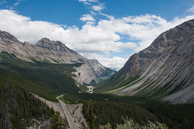
The Icefield Parkway
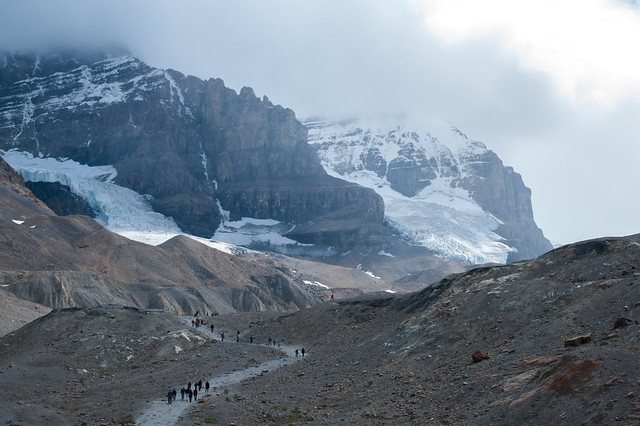
Hiking up to the Athabasca Glacier
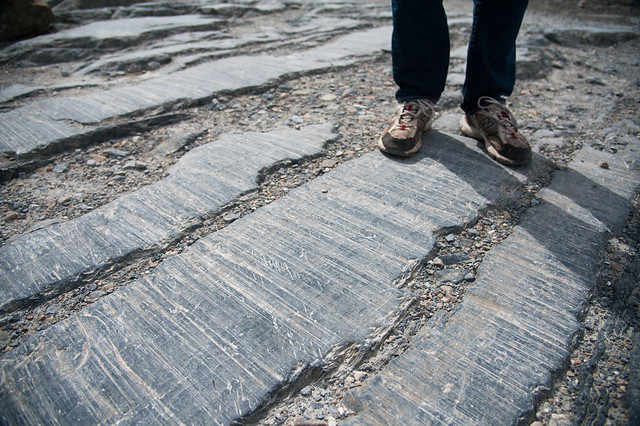
Glacier tracks scraped in the rock
On our last full day in Banff, Matt wanted to do some fly fishing. A friend of his recommended Taylor Lake, one of the most accessible alpine lakes in the area. So, we packed our gear for a day hike and set out fairly early. The hike was about 4 miles up to the lake with about 2,000 ft of elevation gain. It was a steep and steady climb the whole way, and if you combine the high starting elevation with the fact that we were hauling fishing gear, lunches, a chair for me, and camera gear, it might have been one of the more strenuous hikes we did on the trip. After about 2 hours of climbing, the trail leveled out and we slogged through a boggy meadow to our initial view of the lake.
We ate a quick picnic lunch, and Matt scouted a good place to start fishing. We started out near the front of the lake where the trail ends, and where there were several other fishermen had set up for the day. Although Matt got a few bites here, we decided to push on and explore the back of the lake near the waterfall. Here, Matt really hit his stride and started catching lots of big cutthroat trout. We spent several hours here, Matt fishing and me relaxing and taking photos.
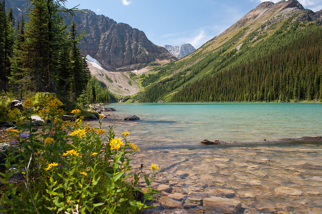
Our first view of Taylor Lake -- well worth the effort to get there
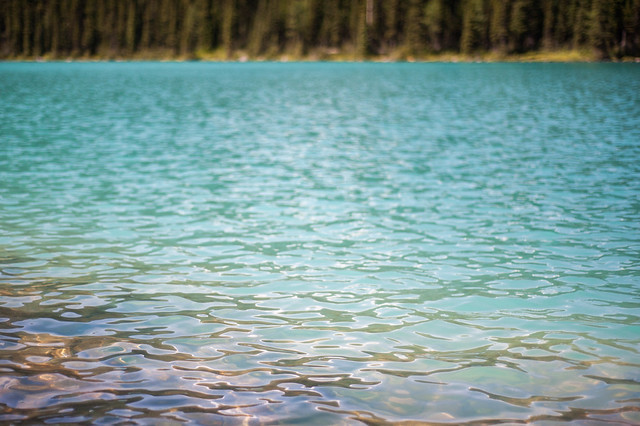
The most beautiful color
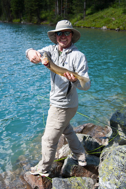
The first catch
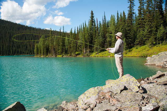
Casting
On our way back down
At the end of the day, Matt caught about 6 or 7 cutthroat trout, and we spent a very beautiful 4 or 5 hours at Taylor Lake enjoying our last full day in Banff. We were still not ready to accept that the trip was mostly over at this point, and so we made our way back to camp for dinner and one last quiet evening on Two Jack Lake. The next two days would be spent driving to Seattle, our new home on the west coast.
All of the photos from our time in Banff can be found here.
No comments:
Post a Comment
Please log into your Google or Gmail account first before typing a comment, otherwise blogger will take you to a login page when you hit "publish" and your comments will be lost!